Europese Unie en Oost-Europa
Pieter Stockmans volgt het mondiale optreden van de Europese Unie, het Europese vluchtelingenbeleid, de evoluties in Midden-Europa en de regio ten oosten van de EU.

For some, it is a nature park with beautiful cycling infrastructure, for others it is an erasure of the Palestinian past. MO* journalist Pieter Stockmans cycled with Israeli and Palestinian cyclists through West Jerusalem — the same region, but with different perspectives. Cycling tourism here is a means of indoctrination, but also of political awareness.
Translation of this article is provided by kompreno, using a combination of machine translation and human correction. More articles from MO* are included in kompreno‘s curation of the finest analysis, opinion & reporting — from all across Europe, translated into your language. Original source.
“Palestinian sites of trauma and memory are replaced by spaces of relaxation and entertainment for Israelis. This mechanism is deeply rooted in the psyche of Israelis.” So writes Israeli historian Ilan Pappe in his seminal work The Ethnic Cleansing of Palestine.
West Jerusalem’s many nature parks are a boon for cyclists. But when the state of Israel was created in 1948, thousands of Palestinians were expelled from the area. Zionist militias destroyed their traditional farming villages. For decades, the inhabitants and their descendants have lived in overcrowded, poverty-stricken refugee settlements.
Over the ruins, agricultural terraces and orchards of the villages, Israel has built not only new Jewish settlements, but also nature parks and tourist infrastructure, with cycling routes and information panels about historic Hebrew sites.
“Whoever relies on the information panels of the Jewish National Fund in the nature parks will never know that people already lived here and who they were.”
“Expropriation was coupled with the process of giving new names to the conquered and destroyed places,” Pappe writes in his book. “A ‘naming committee’ of biblical experts and archaeologists was supposed to Israelise Palestinian geography”.
This is the work of the Jewish National Fund (JNF) to this day. On behalf of the Israel Lands Administration, this private foundation manages 13% of the state’s land in order to “reclaim Jewish land” with donations from Jews around the world.
“If they follow the JNF’s information panels in the nature parks, visitors will never know that people lived here and who they were,” Pappe writes.
The historian calls these information panels on cycling routes “part of a pervasive mechanism of denial that the Israelis have put in place. With a fanciful mix of history and tourist tips, they completely erase from Israel’s collective memory the thriving Palestinian community that was wiped out in a matter of hours by Jewish forces in 1948”.
Every year on 15 May, Palestinians commemorate the loss of their land in 1948 and the modern-day erasure of their culture. The event is known as the Nakba, Arabic for “catastrophe.”

I cycle through the nature parks with Kobi and Naama Peor, two Israeli cyclists from Modi’in. They welcome the work of the Jewish National Fund. The cycling infrastructure in the parks makes for wonderful days on two wheels. At no point in our conversation did the destruction of Palestinian villages come up.
A few days later, I ride through the same nature parks with Anas Dadou, a Palestinian mountain biker from Bethlehem. On gravel roads, closer to the forgotten places where the villages once stood, he reads this landscape differently.
And yet the Israeli couple and the Palestinian cyclist are equally proud of the same nature. The area is in Israel, so Kobi and Naama are showing me their own country. But Anas takes me through this area as if it were his own. After all, Israel was founded in Palestine.
“You can no longer create two states here, think of Israel and Palestine as one country,” Anas will keep repeating.
With Israelis Kobi and Naama, I cycle past President’s Forest. Before 1948, this was the site of the Palestinian village of Sar’a.
“This is an attempt to de-Arabize names, geography and history.”
On 14 July 1948, the Zionist militia Palmach expelled all 390 inhabitants, shelling the village with mortars and blowing up houses. After 1950, a new village was built on the site of the Palestinian village. It was given the ancient biblical name of Tzora, after the birthplace of Samson, the Old Testament Israelite judge.
The JNF also planted pine trees on the site “in memory of Chaim Weizmann, Israel’s first president”. The remaining ruins of Sar’a are declared “archaeological sites”. Israeli historian Ilan Pappe speaks of “an attempt to de-Arabise the site, its names, its geography and, above all, its history”.

In his book, Pappe does not mince words: “In Israel and large parts of the world, the JNF is seen as a respectable ecological agency diligently planting trees and paving the way for nature parks. But their real mission is not primarily ecological, but to cover the visible remains of Palestinian villages with trees and stories. To eradicate any memory of those villages.”
“Ecological awareness, Zionist ideology and erasure of the past go hand in hand. The JNF is ecologising the crimes of 1948.”
The first climb on our bike ride is a beautiful tarmac road through the Martyrs’ Forest. The JNF planted this forest in 1946 in memory of the victims of the Holocaust (as explained here).
The climb appears on my GPS as a 14 kilometre col. At the top, at 700 metres, we stop for a drink at the Sataf Café. There is a lovely view of the distant valleys and peaks of the Judean Hills.
A group of Palestinian schoolchildren make an excursion through the olive groves on the flanks towards the ruins of Sataf.

The name Sataf refers to the ancient Palestinian riverside village that lay at the bottom of the valley before 1948. Ilan Pappe writes about that village: “In 1949, Jewish immigrants from Arab countries were sent here to take over the houses of Sataf. Only when these new settlers proved unruly did the JNF decide to turn the village into a tourist site.”
“The naming committee found no connection with Jewish sources. The name Sataf remained.” Yet there appear to be “Israeli trees” in Sataf. This can be read on the JNF’s webpage on Sataf.
“Here you can see agriculture from Biblical times,” the JNF boasts. But it was here until 1948, when Zionist militias destroyed the Palestinian village.
“The Arab village of Sataf was abandoned during the Israeli War of Independence,” writes the JNF. The houses and agricultural terraces are said to have “fallen into disrepair”, and small plots of irrigated land are “a remnant of an ancient culture that has almost disappeared”. There are “orchards of Israeli trees — olives, grapes, figs, almonds and pomegranates”.
The website goes on to explain that JNF workers rebuilt the agricultural terraces and irrigation channels in the 1980s “with the help of the JNF’s friends in Switzerland”. Thanks to these efforts, the JNF says, “today we can see terrace farming as it was practised in biblical times”.
However, this type of farming was practised here until 13 July 1948, when the Zionist Palmach militia attacked the Palestinian village and blew up the houses.
Zochrot, an Israeli NGO, maps the destroyed Palestinian villages. “The population of Sataf was Muslim,” the organisation quotes from All That Remains, an encyclopaedia of the history of these Palestinian villages by renowned Palestinian historian Walid Khalidi. “The land was planted with grain, vegetables, olives and fruit. The villagers sold their produce in the markets of Jerusalem. The area around the village spring became an Israeli tourist site”.
But in the Sataf Café, Kobi, Naama and I just talk about how wonderful it is to cycle here.
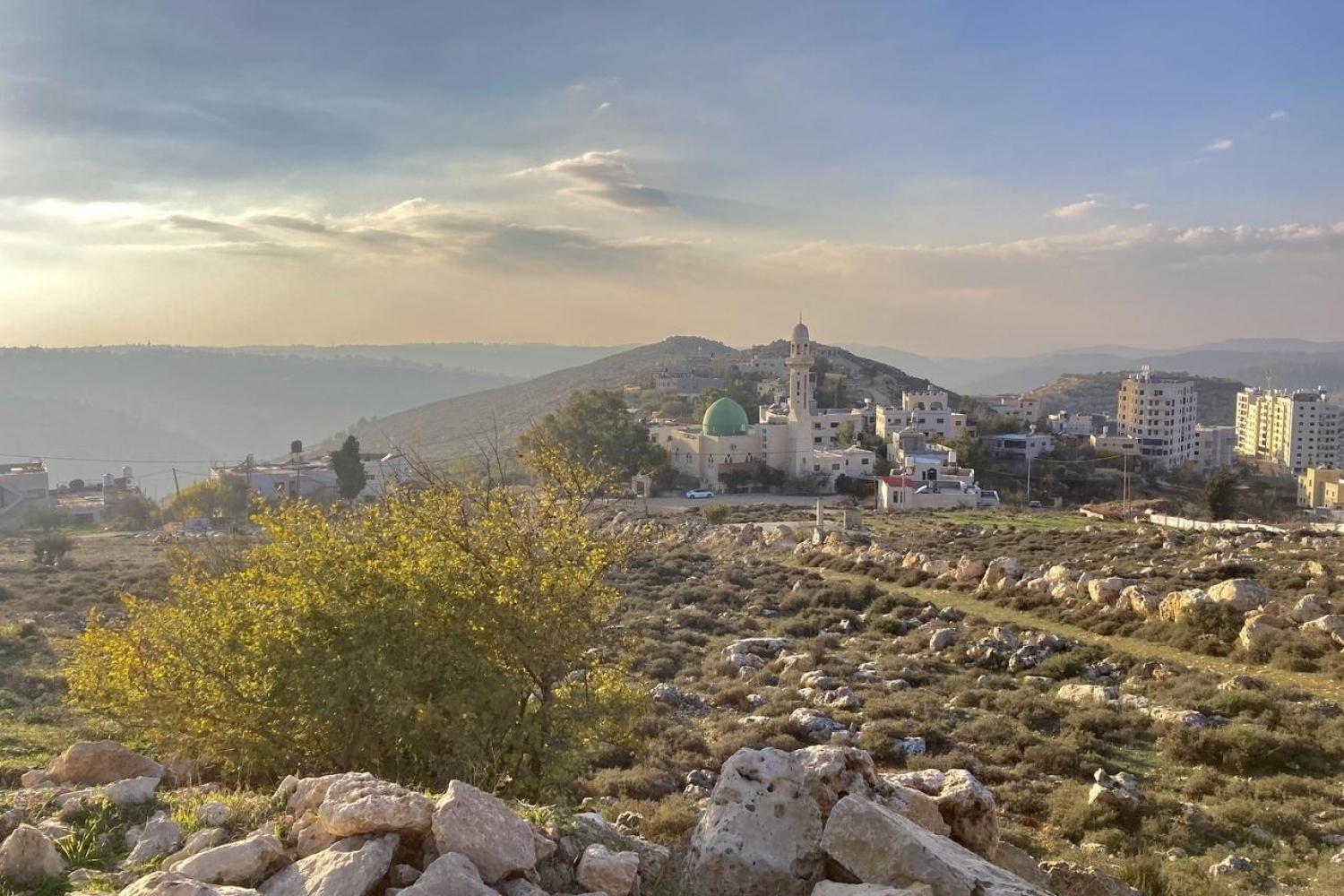
In Ein Kerem, we are closest to the city of Jerusalem. 75 years ago, Ayn Karim was a lively Palestinian town. It was one of the largest communities in the Jerusalem district, with 3180 inhabitants, mosques and churches, two schools, a bookshop, a pharmacy, a theatre, sports clubs and a scout movement. The inhabitants made their living by growing olives and grapes.
150 Jewish families took up residence in the abandoned houses. The village center was restored. It now houses coffee and ice cream bars and restaurants.
On 18 July 1948, Zionist militias began shelling Ayn Karim with mortars. According to Israeli historian Benny Morris, many villagers had already fled in April after hearing about what had happened to Dair Yassin, a village four kilometres away.
There, the militia had shot the residents in cold blood. The massacre caused many residents of surrounding villages to flee in fear. That same year, 150 Jewish families moved into the abandoned houses of the Palestinian residents of Ayn Karim.
The village centre (seen in this video) has been restored and now houses coffee and ice-cream bars and restaurants. “Ein Kerem is an old village with Christian, Muslim and Jewish heritage. It is very cosy. They have delicious ice creams there,” says Naama.

In the urbanised area around Ein Kerem, it is not easy to see any of the ‘biblical’ scenes, but here and there we can still catch a glimpse of the flanks and valleys covered in olive trees and agricultural terraces. These areas are now protected as part of the Ein Kerem National Park, where beautiful cycling infrastructure has also been built.
“It’s the first time I’ve cycled on this path,” says Naama, as we ride along a new cycle path between the hillsides and through the Kerem tunnel, right through the mountain.
On the other side of the Kerem tunnel begins Rephaim Stream Park. The road, accessible only to cyclists, climbs like a col with hairpin bends to an altitude of 850 metres. The Nakba, the annihilation of Palestinian culture by turning existing villages into parks, continues here to this day.
A long trail winds down the side of the mountain and across the valley. It looks like a wound that cuts right through the agricultural terraces on the hillside. It is the Annexation Wall, built by Israel to incorporate Jewish settlements in occupied Palestinian territory into Israel.
From behind the hill comes the sound of an Islamic muezzin calling to prayer. The sound seems to come from another world. And so it is for Kobi and Naama — another world. For them, this is the Rephaim Stream Park, one of Jerusalem’s many nature reserves. But we are riding through the expropriated farmland of the Palestinian village of Al-Walaja. The centre of the village is on the hilltop across the valley. It is like a foreign country where Kobi and Naama never go.

The cycling infrastructure, the roads, the wall: everything is constructed so that the physical and mental space in which cyclists move is always Israeli. Palestinian town centres are behind the wall and agricultural land is in front of it, separated from its Palestinian owners.
I decided to break out of this physical and mental apartheid. A few days later I will go cycling in Al-Walaja.
The ‘local inhabitants’ are Palestinians, who are cut off from their olive trees by the nature park.
In the middle of the climb, Kobi and Naama want to show me a water spring. Four Israeli teenagers are swimming in it.
A JNF information panel reads: “The ancient olive trees on the terraces reflect the dedicated care of the local inhabitants over the centuries. This has resulted in a unique cultural landscape. The springs are being restored and developed for the benefit of the growing number of visitors. Water was of paramount importance in the past, and still is today”.
No mention is made of the fact that these “local inhabitants” are Palestinians, cut off from their olive trees by the nature park itself. The “dedicated care” of these Palestinians is still their livelihood, but is explained as a relic of the past that Israelis can visit on walks and bike rides. And the “ancient spring” was once a water reservoir for the farmers of Al-Walaja.
With Israeli cyclists Kobi and Naama, I cycle 15 kilometres down the wide tarmac road through the valley of the Sorek. This is one of Israel’s longest rivers, from the Judean Mountains near Jerusalem to its mouth in the Mediterranean.
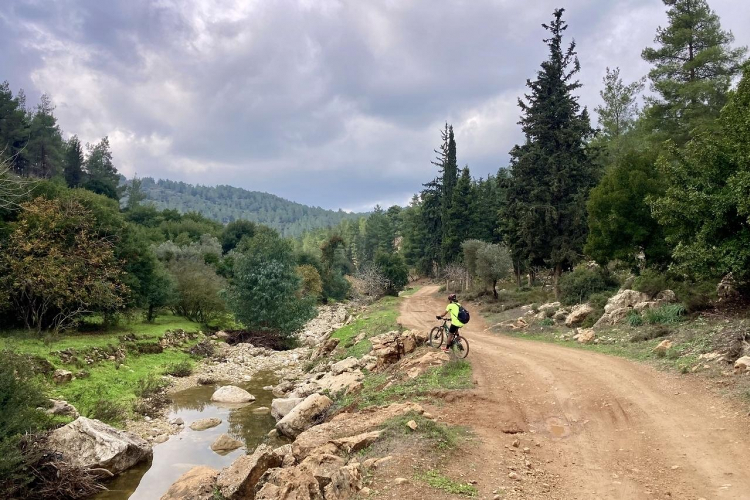
Where the Rephaim meets the Sorek is where the Sorek Nature Reserve begins. And so begins our next ascent. This one takes us higher and higher above the riverbed. Unsuspecting, we enjoy the beautiful view. But somewhere down in the valley were the Palestinian villages of Deir as-Sheikh and Aqqur.
With Palestinian mountain biker Anas, I ride along the gravel roads in the valley where the villages used to be. The road winds up and down like a rollercoaster through the gorge, along the river.
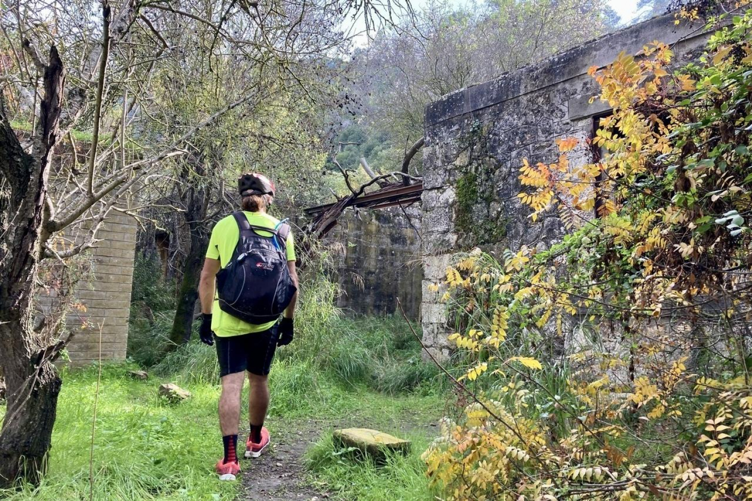
Suddenly we see a sign for the old railway station of Deir as-Sheikh. The ruined village lay on the old railway line from the coast to Jerusalem. The dilapidated and abandoned little station is listed as a ‘place of interest’ on the hiking trails.
The gravel road winds on, between higher and higher mountains, past more and more spectacular rocks. Somewhere here was Aqqur. The Palestinian historian Walid Khalidi writes: “Olive trees surrounded the village on all sides. The adjacent slopes, covered with wild trees and herbs, were used for grazing and as a source of firewood”.
Fellow Israeli historian Benny Morris writes that the village was captured on 14 July 1948. On the site, the JNF planted pine and cypress trees in memory of influential American Jews. The ruins of Aqqur are still visible in the forest.
The setting is paradisiacally beautiful and peaceful — a stark contrast to the impoverished refugee neighbourhoods around Bethlehem where the residents and their descendants live today.

Anas takes me to the next nature park, on the plain between the Judean Mountains and the coast: British Park, created by the JNF with the support of British Jews.
The 13-kilometre-long single-track mountain bike trail through the park is thrilling. Is Anas bringing me here because he wants to share this feeling as a passionate mountain biker? Or as a Palestinian who wants to point out that this nature park includes the village of Ajjur, which existed here before 1948?
The challenging mountain bike trail climbs and descends to the highest point of the nature park, right through the former agricultural land of the Palestinian village. The many old wells still bear witness to this past.
The JNF itself says: “We have laid out the park with scenic routes, footpaths, viewpoints, recreational areas and picnic areas. The abandoned orchards are still thriving”.
In the recent past, these were not “abandoned” orchards, but the livelihoods of Palestinians.

We reach the top of the Ramat Avishur plateau, 375 metres above sea level, exhausted. An Israeli family is having a picnic. The tea they offer us is delicious.
Anas tells them about his experiences in Hebron, Tel Aviv and Bethlehem. These are cities in Israel and occupied Palestine, but they seem to be talking about the same land, as if they share it. “If only we could, as equals,” Anas says as we drive down.
It is getting dark. We are back in occupied Palestine. There, at the military checkpoint, we put our bikes into a taxi van and head back to Bethlehem.
A few days ago I cycled with Kobi and Naama through the former farmland of Al-Walaja. Now I cycle alone to the centre of the village, to the world behind the wall.
From the farmlands annexed by Israel, I have to cycle eight kilometres to an Israeli checkpoint in the town of Bethlehem, and from there another six kilometres on the other side of the wall to the village centre.
I climb out of Bethlehem, past churches and centuries-old houses. Again the wall cuts through a valley of olive trees to separate an Israeli settlement road — between Jerusalem and the Jewish settlement of Gilo — from the Palestinians. In front of me is Har Gilo, which once began as an extension of Gilo on land belonging to Al-Walaja. A few years ago, Israel built the wall here to annex Har Gilo.

A gravel road descends. Suddenly, an incredible sight appears: the setting sun casts misty orange rays over the olive terraces deep down in the valley. A shepherd is passing by with his sheep. Is this a remnant of the paradise we know from the Bible, the charming farming villages nestled in the valleys and on the hills?
It still exists, but the agricultural terraces of Al-Walaja are being incorporated into Israel’s Rephaim Stream Park on the other side of the wall, turning living agriculture into history. It is ironic that actual traditional — Palestinian Arab — agricultural life is being destroyed to tell the story — on an information panel — that it was once Hebrew.

From Al-Walaja, I ride along a gravel road on the mountainside towards Battir, a Roman village that feels like an Italian mountain village. While Al-Walaja is under threat, Battir has successfully resisted the transformation of its ancient agricultural way of life into a park. It has even been recognised by UNESCO as a World Heritage site.
In 2012, the Israeli Ministry of Defence wanted to build the annexation wall right through the Roman terraces and water sources. To this day, local residents use this Roman infrastructure to irrigate their crops in the valley.
The village of Battir successfully resisted turning their traditional way of life into a park.
But this time the Israel Nature and Parks Authority sided with the Palestinian villagers. It was the first time an Israeli government agency had successfully changed the route of the wall, and Battir was preserved as a Palestinian village. Unfortunately, it was a Pyrrhic victory: the new route would not separate the village centre from its lands, but would simply annex Battir to Israel altogether.
Resistance in Battir was also successful in 1948, but even then it was rare. Local leader Mustafa Hassan ensured that the fleeing population could return to the village, and Battir continued to exist. A Roman fountain bears Hassan’s name ever since.
The 1948 armistice line ran through the village. “Here we are on this line, the Green Line. Do you see anything?” says Anas as I cycle along with him. The Green Line is the supposedly recognised border between ‘Israel’ and ‘Palestine’ (the West Bank), but in the real world there is no border anywhere.
“Look, this is Battir’s primary school,” Anas says. “It’s in Israel. Whereas Battir’s shop, where we just bought food, is in Palestine. It doesn’t make sense.”

The real border here is defined by the requirement for Palestinians to apply for a permit from the Israeli army. “Since I started cycling seven years ago, I don’t think about asking for a permit,” says Anas. “I take my bike and go where I want. This is my country too.”
“If you consider this one country, then so do I. I am a human like you.”
Suddenly Anas stops at a bridge over the gravel road and says: “A few months ago, I met two Israeli soldiers at this point — a strange sight in the middle of nature. They asked me where I was from. I said, ‘Bethlehem, Palestine’. The soldiers said I was not allowed to come here. But I replied, ‘You are from Tel Aviv and you are allowed to be here, in a Palestinian village. If you consider this to be one country, then so do I. I am a human being like you. I am just a cyclist.’ At the end of the conversation, they looked at me in surprise and said I could go on.”
After the bridge, a gravel road runs through the valley of the Rephaim and Sorek rivers. It looks idyllic, a little like Switzerland. “We sometimes call it Swiss Palestine,” says Anas.
He does not mention it as something to be proud of. “There were many Palestinian villages here,” Anas continues. “They are now covered with European species of trees, planted for this nature park.”After the destruction of Palestinian villages such as Al-Qabu, which had existed since Roman times, pine trees were planted over them in the 1950s. This became Begin Park. It was named after Menachem Begin, Israel’s sixth prime minister, who was a member of the Irgun terrorist group before 1948. The ruins of the mosque can still be seen among the trees.
According to historian Ilan Pappe, the JNF chose conifers over native Palestinian flora “to give the country a European look”.
Some Palestinian refugees want to commemorate the villages buried under the forests, but it is the JNF’s job to prevent this. Anas believes that the bicycle is an ideal means of visiting and commemorating the sites of the former villages.
“Golda Meir, an Israeli prime minister, once said that older Palestinians would die and younger ones would forget,” he says. “An old man here once showed me, in tears, where his village used to be. I want to bring young people here on bicycles and tell them about the villages. We will never forget.”
Word proMO* net als 2798 andere lezers en maak MO* mee mogelijk. Zo blijven al onze verhalen gratis online beschikbaar voor iédereen.

Pieter Stockmans volgt het mondiale optreden van de Europese Unie, het Europese vluchtelingenbeleid, de evoluties in Midden-Europa en de regio ten oosten van de EU.


![]()
![]() 2798
2798
![]() 11.11.11
11.11.11 ![]() Search for Common Ground
Search for Common Ground ![]() Broederlijk Delen
Broederlijk Delen ![]() Rikolto
Rikolto ![]() Zebrastraat
Zebrastraat ![]() Fairtrade Belgium
Fairtrade Belgium
![]() Memisa
Memisa ![]() Plan
Plan ![]() WSM
WSM  Oxfam België
 ![]() Handicap International
Handicap International ![]() Artsen Zonder Vakantie
Artsen Zonder Vakantie ![]() FOS
FOS
![]() Unicef
Unicef ![]() Dokters van de wereld
Dokters van de wereld ![]() Caritas Vlaanderen
Caritas Vlaanderen
© Wereldmediahuis vzw — 2024.
De Vlaamse overheid is niet verantwoordelijk voor de inhoud van deze website.